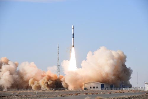
China launched a new remote sensing
satellite from the Jiuquan Satellite Launch Center to provide photographs to
commercial clients while helping with harvest assessment, geological disaster
prevention and resource surveys.
The Jilin-1 satellite constellation was
developed on China’s Jilin Province and is the country’s first self-developed
remote sensing satellite for commercial use. Data will be provided to
commercial clients to help them forecast and mitigate geological disasters, as
well as shorten the time scale for the exploration of natural resources.
The satellites were developed by partner
CGSTL under the Changchun Institute of Optics, Fine Mechanics and Physics, Chinese
Academy of Sciences.
The new satellite, Jilin-1 Gaofen-2A, is
the 14th satellite of the Jilin-1 constellation and will be operational at an
altitude of 535 km orbit. The satellite can obtain a static push-scan image
with a full-color resolution better than 0.76 meters and a multi-spectral
resolution better than 3.1meters. Images width is greater than 40 km. The
images are transmitted to the ground stations via digital transmission with a
rate of 1.8Gbps. The launch weight is 230 kg.
High resolution Earth imaging satellite for
the Jilin-1 commercial EO satellite constellation.
